Tuesday, June 12, 2012

Cross-country track so far (2008 - 2012)

Below is the 3,390 mile track of our cross-country adventure to date. Now that the missing piece in the middle has been completed, I really feel like we have accomplished something.


2008: Tour d' Fred - Little Rock, AR to Gainesville, FL, 1180 miles.

2009: Pirate Tour - Gainesville, FL to Key West, FL, 590 miles.

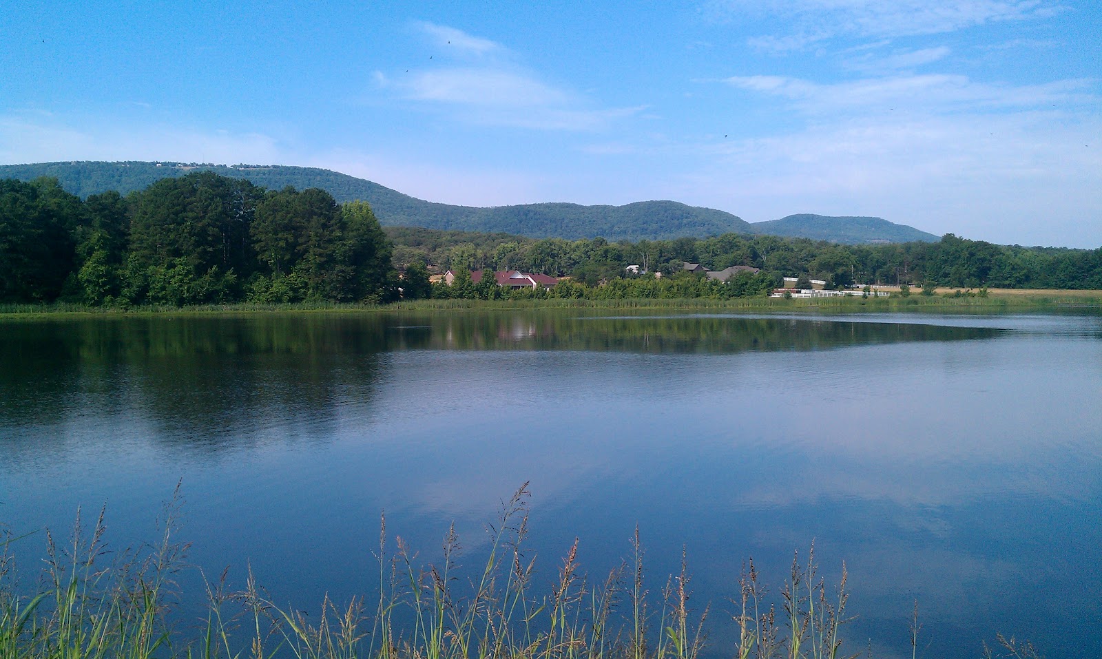
2011: Geezer Geyser Tour - Colorado Springs, CO to West Yellowstone, MT, 650 miles.

2012: Plod Across the Plains - Colorado Springs, CO to Little Rock, AR, 970 miles.

Next summer we plan to complete the diagonal by riding the final 1,000 miles or so from Yellowstone or from Jackson Hole, Wyoming to Seattle, Washington.

Saturday, June 9, 2012

June 9, 2012: PAP Day 15, Morrilton to Little Rock, AR

After my long nap yesterday afternoon and a full night's sleep, I felt pretty good this morning. Last night we came up with a change from our original plan for today. Fred had decided that he wanted to drop his bike at a bike shop to get it packed and shipped. One of the candidate shops was along our route, just a couple of miles from The Big Dam Bridge, a must-do for me since our first visit to Little Rock in 2008. There were no shops convenient to our hotel near the airport, so we decided to finish the tour at the bike shop after riding across the Big Dam Bridge. Instead of me riding the additional 10 miles to the hotel, we would just catch a cab from the bike shop. In the end, that is exactly what we did. The cab ride was a high-speed, harem-scarem adventure that seemed far more risky than the 970 miles we had ridden on our bikes!

An hour or so after we started today's ride, I had a flat -- the first and only "mechanical" on the entire tour. I had picked up a one inch nail, so I can't really fault the tires. They have rolled over a huge amount of debris, gravel, glass and more without complaint.


North Little Rock: We like bikes, but not teens.

The other big event of the day, of course, was The Big Dam Bridge, which is a bike/pedestrian trail built on top of a dam, hydro-electric power generator, and shipping lock. The trail is almost 5,000 feet long and most definitely worth a visit if you are biking in the area. Here are some photos:


Fred and I agree that the Plod Across the Plains was a most worthwhile endeavor. It was, as expected, a challenging ride, though we were really quite fortunate with conditions. Yes we had headwinds most every day, but they were not as strong as they easily might have been. In addition, we did not have any super-hot days. In fact, I don't think the air temperature made it above the high 80's or low 90's. We had only one rain day, and thankfully it happened to be one of our short days. The big fear, tornadoes, never appeared, though we saw that people living here are keenly aware of the possibility. It is much more of a presence in their lives than are hurricanes for Floridians. Our conversations with the tornado survivors in Greensburg won't be forgotten any time soon.

End-point of the Plod Across the Plains
We learned first-hand that Oklahoma has an eastern section that is far from flat, and western Arkansas has plenty of ups and downs as well. We did MUCH more climbing than we expected. As on our other trips, we had some wonderful encounters with local residents. We got a first hand look at the mind-boggling scale of the food production in our nation's central plains and at the people who scratch out a hard existence to assure that we have food to eat. There is more here than farming, though. The region is being resurrected by a new wave of oil production and by a vibrant new industry related to wind farms.

In terms of our bike touring, we decided that rolling rest days are nonsense. At least for guys our age, a day off the bike at least once each week is a necessity. Finally, once again, I was reminded that foul weather can occur even when it seems very unlikely, so the packing list should always include clothes to keep you warm and dry on the bike.

The stats for the entire tour go something like this:

Count:15 consecutive days of riding
Distance:967.36 mi
Time:77:27:52 h:m:s
Elevation Gain:18,620 ft
Avg Speed:12.5 mph
Calories43,601


Friday, June 8, 2012

June 8, 2012:PAP Day 14, Paris to Morrilton, AR

Just to prove that this tour has not been all wheat and corn fields, here is a nice Ozarks photo from today:


We left Paris, Arkansas at about 7AM. Most of the ride was the normal up and down, but toward the end it flattened out for quite a while before slapping us with a couple of climbs to get to our hotel. The flats were not all good news, because that is where we encountered the most wind of the day as well. Nothing terrible, but enough for us to take turns up front.

Apparently all the physical challenges of the past two weeks caught up with me today. I was really pooped by the end of the ride -- so pooped, in fact, that I slept for three and a half hours after returning from lunch! A nap of any kind is an extreme rarity for me, so it underlined what I am feeling in my legs. I am always sad at the end of these adventures, but my body will be very happy to have the opportunity to recover.


Thursday, June 7, 2012

June 7, 2012: PAP Day 13, Ft. Smith to Paris, AR

Today was a "rolling rest day" so we got up later, took advantage of the hotel's breakfast buffet, and finally started riding a few minutes after 9. The route was a straight shot east on highway 22, through a series of small towns, to our next overnight in Paris, AR. Apparently there is also a London, AR in the area.

We did as well as we could to take it easy on our legs but we still had to make headway, and we had both the hills and headwinds that have been a feature of the past five or six days. In fact, it dawned on me today that we are now riding over the rolling floor of a valley in the Ozark Mountain Range. We most definitely are no longer in Kansas, or Oklahoma, for that matter. Looking at the route for the next (and last) two days of the tour, we will be threading the needle between mountains, which surely will mean lots of climbing. I can feel twinges in my calf and knee just thinking about it.

Back to today, though. A few miles west of Paris we spotted Cowie Wine Cellars and Vineyard. Fred suggested that we stop to check it out and I readily agreed. It turned out to be an award winning little winery, but also the site of a little chapel and bell (think church bells) collection. You can see and hear the bells in action in this youtube video. Our tour of the facility was certainly the high point of the day, and a very nice surprise.

Proprietor's house and wine shop.


Fred tries his hand at ringing one of the larger bells.

The interior of the lovely little chapel, almost complete and ready for use. The pews, alter, and crucifix were all hand-made.

Wednesday, June 6, 2012

June 6, 2012: PAP Day 12, Muskogee, OK to Ft. Smith, AR

Today was scheduled to be A long ride, but not THE long ride of the tour. After some route adjustments last night, and a wrong turn early in the ride, it turned into the longest distance, the longest saddle time, and the most climbing of any PAP Tour ride to date: 91 miles, 7 hrs 53 minutes, and 2500 feet, respectively. In addition, virtually every mile of the 91 was into a 10 mph headwind. making for slow progress and a challenging day.

This time last year, I had conclusively demonstrated how unsuited I was to the high altitudes and cold temperatures of Colorado and Wyoming. This year it is Fred who is suffering in the high 80's and low 90's we have been experiencing for the past few days. He is dumping water over his head at every opportunity, while I stand by, barely sweating and not at all uncomfortable. Probably also related to the heat, Fred is experiencing cramps in one of his calves.

Today's route was especially challenging for me to create. I was trying to keep the distance in check, piecing together portions of routes suggested by Google and by Garmin's MapSource software. I am pretty much ready to give up on the former, as it has consistently put us on unpaved roads that are not suitable for my touring rig with 28mm tires, much less Fred's 23's. When we got screwed up today, a local was able to put us back on track, but our wrong turn added at least six miles to a day that was already going to be long enough.

There isn't much more to say about today. Toward the end of the ride, I drank one and a half of those monstrous plastic cups of Cherry Coke at a Hardee's ("No, we don't have the fish sandwich any more.") About an hour later I chased it with a regular 12 oz. can of Vanilla Coke at a convenience store. Perhaps it was just psychological, but the jolt of sugar and caffeine sure seemed to push aside the weariness and I finished with energy to spare.

Back in Arkansas, where the adventure began!
Tomorrow is our second planned "rolling rest day." The last one, you may recall, turned into a nasty, cold, wet ride. The weather forecast for tomorrow looks good at the moment, so we are going to sleep in (like to 7:00 AM or so) and take it easy for the 44 miles to Paris, AR. At least, that's the plan.

Tuesday, June 5, 2012

June 5, 2012:PAP Day 11, Sand Springs to Muskogee, OK

We left the hotel in Sand Springs (a Tulsa suburb just west of the city) at what has become our customary time over the past five or so days, 8AM. Yesterday I had looked up the Tulsa bike trails map on the web, and a young woman at one of the very few still viable K-Marts (next to our hotel) confirmed that we could pick up the trail just a couple of blocks away. That information turned out to be entirely accurate, so we were riding along on fresh asphalt, under a tree canopy, within two minutes of departure (shown just below). Once on the trail, the map made it look like we would be able to follow one or the other part of the trail system for at least the first half of today's 60+ mile ride to Muskogee.


According to the trail map, each trail we were taking should have merged seamlessly with the next, but at the end of the first trail we ended up off-trail in the city of Tulsa.Within a few seconds two local female riders appeared to provide the needed directions, including what to do if we were blocked by a train on the normal route, which we were. Initially we thought we would just wait for the train to pass, but after a while it stopped completely. 


We decided to backtrack and try the alternate route. It was only a few blocks out of the way, went under the tracks, and soon we were on Tulsa's magnificent River Park East trail. The northern part of this trail was most impressive. It even had separate trails for bikes and pedestrians.

The left side shown here is for bikes and the right is for walkers and runners.


A little overlook alongside Tulsa's River East multi-use trail.

The river you see in the above photo is the Arkansas. It is very, very low, with as many dry areas as wet.

One thing that did not impress us about the Tulsa trails, however, was the typical attitude of the cyclists we encountered on them. Very rarely would we get any acknowledgement to our greetings. The Tulsa riders make the Orlando crew look like they mainline happy juice, by comparison.

The trail follows the river around the western edge of the city. Once clear of Tulsa proper, it joins with another trail that heads east. After 30 miles, our route and that of the trail system diverged, so we got off. We were now faced with either letting Garmin guide us, or following the bicycle directions that I had imported from Google Maps as a track on the GPS. The latter had put us on a dirt road back in Kansas, so we were a bit gun-shy of Google routing. On the other hand, Garmin had us going miles in the wrong direction in order to get on a highway. The area we were in was country, but not like in Kansas, where we were routed onto the dirt road, so we decided to give Google another chance, and rode off -- up a steep hill, of course.

Shortly, it occurred to me that I had selected "fastest" rather than "shortest" on the GPS, so I recalculated using the "shortest" option and it came up with a route similar to the one suggested by Google. I have the GPS "avoid unpaved roads" option set, so the fact that the GPS route matched Google was encouraging. We ended up using a combination of the two routes and had no further difficulties finding our way here.

The weather today included a fair amount of headwind, a bit of happy tailwind, pretty intense sunshine, and high temperatures. We had no overcast at all, so by the time we got in at around 2PM, we were pretty hot. We agreed to get going a couple of hours earlier tomorrow, which is our last long day (76 miles). If the wind gods are agreeable, we should be able to get off the road by 1 PM.

At one point in today's ride, we stopped to refresh our sunscreen. During that procedure I removed my watch, laying it on top of one of my panniers (saddlebags), making a point to remind myself to put it back on when I was done slathering my arms. You already know what happened. About 20 minutes later, I went to check the time and my bare wrist looked back at me. I instantly remembered -- that I DIDN'T remember  -- to put my watch back on. I slowed down and when Fred pulled up, I told him I had lost my watch. He then pulled it from his back pocket. I thought he must have caught my mistake when it happened, pocketing the watch to teach me a lesson. In fact, however, my watch sat happily on top of my pannier for quite a few miles, finally bouncing off a mile or so before I noticed it, whereupon Fred stopped to pick it up. He had fallen behind as a result, and I stopped to wait for him, but I figured he must have caught a light or something as we rode through the little town we were in. I am very grateful to have not lost the watch, and treated Fred to a fine meal at iHOP (money was no object!) while we waited for our rooms at the hotel to be readied.

The last bit of news for today's post is that Fred's replacement Droid X (the original apparently having been killed by our ride in the rain a few days back) was here at the hotel. Of course, Oklahoma is US Cellular, not Verizon turf, so he had to get to the appropriate support tech at Verizon and go through a magical process to (partially) activate the replacement phone. He was told to wait until he is back in Verizon country to enter his Google Account credentials. That makes zero sense to me, but whatever!

Monday, June 4, 2012

June 4, 2012: PAP Day 10, Stillwater to Sand Springs, OK

We got back on Highway 51 at 8 AM and headed due east, our destination today being Sand Springs, a western suburb of Tulsa. As you can see from the ride profile below, it was pretty much a roller-coaster series of climbs and descents until we got within ten or so miles of our hotel for the night. The climbs were longer but most were less steep than yesterday. The wind never became an issue today, in part because this region of Oklahoma is most definitely not flat, and the great open fields have been replaced by lots of trees -- even forests -- that provide a wind break. Given the light wind, easy climbs, warm temperature, and slight overcast, we had a very pleasant ride. At this point in the tour, a 61 mile ride, even with hills, is just another day at the office, as long as the wind behaves.

Within a mile or so of starting out, I noticed a credit card lying in the street. I stopped and stuck it in my pocket, figuring I would call it in later. Another mile down the road I found a new-looking Liz Claiborne women's wallet, containing just a credit card and a $25 gift card. I added it to my stash. When we got to our first rest stop, I compared the name on the loose credit card with the credit card in the wallet and was not surprised to find that they matched. Apparently this poor woman's wallet was either lost or stolen, and probably the latter, given the absence of cash or ID. Later in the ride, I picked up one of those little metal miniature cars, so it was really quite a day for roadside finds.

When we reached our hotel and I had cleaned up, I called Chase (the issuing bank for both of the credit cards) and told them the story. The have a policy that prevents them from giving me any of the card-owner's information (expected) or from giving my contact information to her. They were grateful that I reported the cards, and told me to cut them up and dispose of them. After mulling it over, I think I will send the wallet to the Stillwater police department. Perhaps there will be some fingerprints or something that might help them catch the creep who stole the contents of the wallet. At the very least, they can return it to its owner.

*   *   *

Fred: "I recently went to Boulder for a structural equation modeling conference..." (A minute or so passes while cars and trucks go by.)

Seth: (grinning) "So, are you just going to leave me hanging?"

Fred: (makes rude gesture involving a single finger.)

Both: (laugh)

Now for some bird stuff: While out in the country here in Oklahoma, you often see the State bird, the Scissortail Flycatcher. I was hoping that Reinhard had a photo that I could include here, but I guess he has not yet been to this part of the country. There are lots of great photos of this bird on Flickr, however, such as this one. He would be a beautiful little guy even without his fantastic, long tail. Below is a flock of swallows foraging near a bridge over a river. There has been a similar scene, different only in scale, wherever we passed over even the smallest stream, starting the first day of our tour. I think they are Northern Rough-winged Swallows, but I'm not 100% sure.


Five miles or so from the hotel, we stopped at this roadside shrine (below) for a pair of local cyclists who died at that location.


Sunday, June 3, 2012

June 3, 2012: PAP Day 9, Enid to Stillwater, OK

We left Enid at 8AM, hoping that the local TV weather forecast would be more accurate than the one from Weather Underground. If so, the rain would hold off until late afternoon, as would the higher winds.

Before we turned the first pedal, I noticed that the GPS on my bike was pointing us north rather than south. A continuing issue with Garmin is that the routing algorithm used by the Garmin MapSource software is not the same as that used by their portable GPS units. The only way to assure that the same route will show up on the GPS is to plant a bunch of via or way points between the start and end points. I neglected to do that last night, hence the confusion.

For once, Fred and I remembered the beginning of the computer route the same way, so we headed south and made the first turn, onto a paved, but narrow, road that quickly took us out of the city and into the vast fields of wheat and corn that have become so familiar to us now. There was a light, variable wind and overcast skies that did not seem to hold any threat of rain. The first hour or so we made excellent progress without excessive effort. Our road finally ended at a "T" and Garmin wanted us to turn north, away from our destination. We stood in the road, hemming and hawing for a moment until a local resident appeared and we (meaning Fred) flagged him down. He eventually mentioned a choice of two paved roads to the south that would take us to Covington, a town we knew to be on our route. We happily turned south, cranked back up to a respectable pace, and after a few miles hit an intersection with a paved road heading east and a small sign showing it to be the way to Covington.

We took a little break at a convenience store when we reached Covington, then picked up the route to another small town called Perry. When we got there, we were about 20 miles from our destination for the day.

Somehow we missed this lovely inn at the Perry, OK truck stop while planning our trip. There is a sign that promises rooms for $29.95, and I am sure they are worth every penny!

 Although technically a highway, this next leg was another low traffic, narrow, paved road. A difference we quickly noticed, however, was that this one started out with a series of 5% hills. Actually, it was nothing BUT 5% hills! For the next 11 miles we were either going up or going down one of them -- into a headwind, of course. All the bicycle riders reading this know how discouraging it can be to finally crest a long hill, only to see another series of two or three ahead of you. Today our eyes beheld such a sight dozens of times. Looking at the total ascent of just 1,687 feet, it doesn't seem like much, but it felt like twice that.

Eventually we reached highway 51 -- at the top of a long hill! Fred took the placement of the intersection as a cruel joke, courtesy of the highway department. The same thought had occurred to me as well. This was the final turn and would take us the remaining 9 miles to our hotel. The pavement was smooth, the wind was at our sides rather than in our faces, and although it did start raining very lightly a mile or two short of our destination, we did not get that wet. There is even a well regarded Mexican restaurant right across the street and I was able to get a very good "Fajita del Mar" that hit the spot after the dietary wasteland of the past few days.

Viva la Fajita del Mar
 OK, one more thing - a Super Walmart is within walking distance, though they did not have my favored brand of sunblock (Ocean Potion), which is stocked by our stores at home. I managed to find a few things to make the walk worthwhile anyway.


Saturday, June 2, 2012

June 2, 2012: PAP Day 8, Anthony, KS to Enid, OK

We left Anthony around 8AM on the 65 mile ride south to Enid. Although we were riding into the wind, it was only 5 to 10 mph, and not a real problem. We rotated pulls every five minutes and that worked out pretty well. We were on a highway that carries much less traffic than others we have ridden this week. Our fellow travelers were all courteous, and even friendly. The only issue with the route was the condition of the pavement once we crossed over the Kansas / Oklahoma state line, early on today’s ride. The roads were badly in need of repair, giving us a rough ride.


At about mile 35 we stopped in a little roadside convenience store, anticipating that there would not be another for a good while. Fred quickly decided that he needed a cheeseburger but I just picked up some snacks. We ended up having a friendly conversation of ten minutes or so with a trio of locals. As so often happens, common ground emerges where it seems highly unlikely. Fred taught for a year at the college from which one of the fellows' daughters graduated. In addition, they all get on their motorcycles and do a trip to the Colorado mountains every summer. OK, no pedals, but still, only two wheels. Relations between motorcyclists and bicyclists are most always quite friendly.

Which of the men above is not actually an Okie?
Back on the bikes we continued uneventfully until about 9 miles from our hotel. Fred declared that he needed a break in the shade. We had just passed an electronic sign that showed the air temperature as just 79, but he felt overheated anyway. We pulled into the parking lot of a commercial farm irrigation supplier to take advantage of their ample, shady overhang. Freddy pulled off all the clothing he could, then stretched out on the cool concrete in the shade, making a series of loud sounds that would be best described as the sound track of a porno film. I won’t miss the next opportunity to record his performance.

Enid is a good-sized town, so we rode through miles of suburbs and past several more miles of strip centers, hotels, fast food joints, and all manner of commercial enterprises before coming to our hotel. Tonight we are in rooms at America’s Best Value, a chain that is well above our recent lodging but below most Best Western, Days Inn, and similar brands. One issue, however, was that we had to hike a good half-mile to get to the first acceptable eatery. In this case it was a walk-up-to-order local bar-b-que place. I had a grilled cheese sandwich, corn, and coleslaw; Fred had some ribs. At 6 the restaurant in the Best Western across the street opens. We are hoping to get something more satisfying this evening over there.

June 1, 2012: PAP Day 7, Medicine Lodge to Anthony, KS

Today was scheduled to be our shortest day (39 miles), with the idea that it would be a “rolling rest day” on which we would just amble along to give our legs a chance to rest. The day started out very cool, with a 20% chance of rain. At about 10 miles we saw that a mass of very dark sky was about to overtake us. As luck would have it, we were coming up on a little town called Sharon, so we got off the highway and started to look around for places we could take shelter until the storm passed by. We found some possibilities at a church, but a woman told us that we might prefer to hole up in the town’s store, just a few blocks away.

We took her advice and located the store, which is cleverly called “The Store.” We parked the bikes right outside the window under an awning, went in, and killed time while the rain came down. Fred had some food and I had a couple of French Vanilla coffees out of a machine that were quite delicious. Really.

It finally stopped raining long enough for us to take a chance. Bad bet, as it turned out, though there probably weren’t any other reasonable alternatives. We rode the remaining 29 miles in light to moderate rain, with one more rest stop along the way. I was wearing a rain jacket, but otherwise had no rain protection. I had pulled out my rain pants, seal-skinz socks, water-repellent long sleeve gloves, and helmet cover before leaving home, figuring that it would be too hot to wear them anyway. Nobody (at least not me) expected a day like this one so late in the spring. Normally temperatures would be up in the 90’s or even over 100 by now. Anyway, by the time we reached our hotel in Anthony, KS, I was soaked and started to feel pretty cold once off the bike and no longer generating heat by pedaling. Fred, on the other hand, somehow managed to carry all his foul weather gear in his little panniers with the rest of his stuff, so he did fine, with one big exception: he had not protected his phone from the rain, and as of yet it has not come back to life. He’s going to let it dry out for a full 24 hours before trying again.

As we came into Anthony, the road was blocked because a truck carrying a single wind turbine blade was trying to maneuver a 90 degree turn. Photos don't begin to do justice to the size of these turbines. Each blade on a full size commercial power generation turbine is up to 125 feet in length!  Fred wasn't able to get a single shot with the entire blade.


The motel in Anthony was run by immigrants from the same region of India as SPOS from the previous night in Medicine Lodge. The attitude of these people was exactly opposite, however. I was asked several times about my opinion of the room (which showed the abuse of the oil people who inhabit the room most nights), and apologies were appropriately offered. They were eager to show us another room (already taken, unfortunately) that had been recently remodeled. They hoped we would visit another time so they could put us in remodeled rooms. Anyway, it is much easier to make peace with deficiencies when dealing with nice people who are doing their best under difficult conditions.

The town of Anthony, while struggling, seems to be in much better shape than Medicine Lodge. There were plenty of empty storefronts, but there were also signs that there might be some hope for the future. We had a pretty good Mexican meal for a late lunch.

May 31, 2012: PAP Day 6, Greensburg to Medicine Lodge, KS

We had planned to visit the Kansas Meteorite Museum outside of Greensburg this morning, but we had some difficulty locating the access road, and when we did, we found it to be a dirt road, made even less appetizing as a result of the previous night’s heavy rain.

We soldiered on in an easterly direction, against an increasingly strong northeast wind. The effort was such that we stopped to rest four times on this 30 mile leg. I learned a new safety tip on one of those stops – don’t sit downwind of your bike, unless the bike is already lying on the ground. Luckily, I was just startled when it blew over on top of me. We were sustained in our struggle by the expectation that the wind would remain from the North, and that the second half of our 60 mile route would be driven by a strong tailwind.

It turned out just as we had hoped. It took us three hours to ride the first 30 miles of the route, and just 90 minutes to do the remaining 30! Flying along at 25 mph, Fred experienced Bike Bliss – a transcendent state that in this case seemed to be triggered by the tailwind and a dramatic change in terrain (from flat fields of grain to hilly, twisty terrain with many more trees).

Kansas is, of course, known for its beef. We have ridden past countless feed lots, and been blown hither and thither by countless livestock trucks. Restaurants in Kansas seem to do their part to push the beef life-style, which often makes it difficult for me to find a meal that appeals. On this day, the closest thing to "my kind of food" I could find was fried shrimp. I like shrimp and eat shrimp often, but I eat very, very little fried food of any kind. A couple of weeks back, at the Georgia Tandem Rally, I found myself facing a huge basket of french fries and fried scallops. I mistakenly assumed they would be broiled, which shows how out of touch with reality I was. The default food preparation method in the South is, of course, deep-fried.

That dose of fried was a foreshadowing of Day 6, on which I had (good) fried shrimp at the Uptown Cafe in Pratt, and, later, a typical basket of frozen popcorn shrimp and fries at a little spot in Medicine Lodge. The latter put me over my limit, resulting in an deep-fried overdose. I got into bed later in a state of nausea. That brings me to our accommodations at The Lodge Motel.

The previous night in Greensboro was spent in a beautiful, new, ultra-clean, and ultra-comfortable Best Western Plus. In Medicine Lodge, we returned to the realm of motel muck, recently seen at the Ken-Ark in Lakin. On check-in, the proprietor, henceforth known as “Stinking Pile of Shit” (SPOS), immediately tried to talk us into exchanging our reservation for two rooms for a single room with a second bedroom, but only one bathroom. Neither Fred nor I believe that anyone (other than those under marital obligation) should have to endure each other's respective arrays of auditory and olfactory nocturnal productions. We therefore nixed SPOS’s suggestion after a cursory look at the room. In the end we settled on one room that the carpenter was supposed to finish this afternoon, and another, older room. Fred made the reservation, so he got dibs and bet on the carpenter.

We off-loaded our gear in my room while construction continued in Fred's. We then rode into the sad little town of Medicine Lodge, with its abandoned storefronts and a shrinking population. Like many other towns in the region, it is enjoying a temporary boom of sorts as the petroleum industry sends hordes of contractors back to the area’s oil and gas deposits for a second try. At present it is difficult to find vacancies even in the most undesirable motels because they are all selling out to itinerant petro-industry workers driving large 4x4 pickups full of equipment.

On our return to the motel, I showered and washed my clothing, then sat on the bed and caught site of daylight framing the closed door to the room. After an bit of inspection, I headed off to locate SPOS, from whom I expected and got no particular concern or compensation of any kind. In glum, problem-solving mode, I inquired whether maybe he had some duct tape or something I could use to prevent a swarm of insects joining me in my room when night falls. He brightened immediately, rightly concluding that I was not going to resort to physical problem resolution techniques, and started pulling various rolls of tape from behind the desk. I chose a wide roll of packing tape and used it to seal myself into the room when I returned to it later to ponder my nausea, and to wonder if sleep would come. (Turned out that the tape did the job, I did fall asleep, and I awoke feeling much better.)


Before


After sealing myself in for the night.


Once the construction in Fred’s room was completed I paid him a visit and found that his room was relatively acceptable. The idea that SPOS was charging the same amount for the two rooms started to get under my skin. I therefore tracked him down and made another fruitless attempt to shame him into some acknowledgement that his approach to inn-keeping was dishonest, immoral, and unethical. He made it clear that he didn’t care at all whether I was happy or not, nor was he sorry to have put me in a defective room without pre-rental disclosure. A plague on your house, you sorry excuse for a human being!

Wednesday, May 30, 2012

May 30, 2012: PAP Day 5, Dodge City to Greensburg

Today was supposed to be on a route off the highway we have been following since the first day of the tour. We tried, but soon found ourselves on an impassible sandy road. We had no real alternative but to return to the highway. Fortunately, the heavy traffic from yesterday was absent today.

Additionally, after four days of 78 - 85 mile days, today was supposed to something of a recovery ride -- only 45 miles, after sleeping in. After checking the weather last night, we changed that last bit, to avoid even higher head winds and possible thunderstorms later in the day. So, basically we had a re-run of yesterday, but about a third shorter. The 45 miles ended up 51, and we again had headwinds of 10 to 15 from the time we left Dodge to the time we arrived at our hotel here in Greensburg.

We passed a long row of these metal sculptures along the highway. No explanation was apparent.
Strangely, Fred was more tired today than yesterday; for me it was just the reverse. I felt pretty good today, and the wind didn't bother me very much, except that I really didn't want to be caught in the open by a thunderstorm, and the wind kept us on the road all that much longer. We did see some rain ahead, but by the time we reached it, it had moved on. There was no sign or sound of thunder or lightning until well into this evening.

We had an fascinating afternoon exploring the town. Greensburg had a brief few years of boom back in the 19th century, but in the years since then it has just hung on, trading on the presence of "the world's largest hand-dug well" and an unusual number of meteorites that are found in the area.
 
Everything changed in May of 2007, however, when one of the most powerful tornadoes ever measured turned 95% of the town into a heap of rubble during its 15 minute nighttime visit. We spoke to several residents about their hair-raising experiences. It is a miracle that so few (12) lost their lives. You can read the details and see some photos on Wikipedia. Really horrific. About half the residents vowed to rebuild the town, and they have, with help from countless individuals, civic groups, and federal and state agencies. Imagine a town where everything is less than five years old! It is also interesting that they decided to rebuild the town as a model of sustainable building practices and technology. As an example, there are 10 community-owned mid-sized wind turbines that supply all the power the town needs and pour the excess into the grid. The town adheres to green standards for all its buildings. I believe that all the private homes and commercial buildings are energy efficient as well.

If you ever have the opportunity to spend a few hours here, you won't regret it.

From foreground to back: large slab where a business stood when the tornado hit, one of the town's wind turbines, our new Best Western, a couple more turbines.

All that remains of a couple of homes that have not been rebuilt. Note that here, in the center of "Tornado Alley", most homes are wood frame structures built on slabs, just like in Florida. I always assumed that homes in this part of the country would all have cellars, but apparently not.

At the Big Well Museum, looking down into the huge, hand-dug well that had been Greensburg's claim to fame before the tornado.

An entrepreneur has created a business re-purposing old gas tanks as tornado shelters. These are bolted into the slab and have room for several people to jam in. It sure beats clutching one another around the base of a toilet, which is how two town residents miraculously survived the 2007 tornado.


Tuesday, May 29, 2012

May 29, 2012: PAP Day 4, Lakin to Dodge City, KS

We left Lakin at 5:30 AM. Now that we are in Central Time, dawn is around 6:30, so it was completely dark for a half-hour after which the sky began to lighten. Speaking of lights, I was very pleased with the first use of my new Cygolite 400. I had it set at the normal "bright" setting, and it completely illuminated the road in front, and far enough to support my mid-teen speeds and more. I am using a Dinotte 300R tail light, which performs spectacularly even in full sunlight, so I had no concerns at all on that score.

Fred has a rear light and two little flashers, none of which are properly mounted to do anything other than to alert insects in the roadway that Fred has just gone by. I thought he had purchased a rear light like mine, but no. After a few of my sarcastic comments, he realized the problem and decided to address it by mounting his bright, white front light on his rear rack, facing rearward, running it in strobe mode. While that approach probably confuses drivers and might earn him a ticket, it is undoubtedly effective. That just left him without front illumination, but he figured he could work around that by following me closely.

This is just one of many areas in which I am unable to follow Fred's logic. He certainly would not see road debris, for example, in order to avoid it. Anyway, all I can do is to offer my opinion. His mind works quite differently from mine, which is one of the reasons I am so fond of him, and why I enjoy traveling with him as much as I do. He seems to have a bit of Mr. Magoo-style luck, so hopefully he will be fine without adopting my style of catastrophic fantasizing and obsessive precautions.

Starting the ride in the dark allowed me to forget to reset and start recording on my GPS-based bike computer until a half-hour later. Of course, I have a second GPS (see what I mean!), so that was just a little inconvenience. Of more import to both of us, was that it was COLD. At the last minute of packing I decided that I was over-packing and unpacked some warmer stuff, including some warmer gloves that would have been very nice to have. I expect the morning temperatures will be warmer each day, and even if not, it is not like I am back on Togwotee Pass, for crying out loud! I have survived the discomfort just fine. Ignore my whining. There were more significant issues afoot. If you have been reading along, you probably can guess.

Yup, the wind. We started with a bearable head-wind that knocked a couple of mph off our pace, but as the day progressed, the head wind just kept getting worse. The result was that the 77.5 mile route took us 6 hours and 49 minutes in the saddle, making it the longest ride of the trip time-wise, and the most draining for me. Fred thinks yesterday was worse, but I think it is just because I spent much more time at the front today and he has become pretty adept at finding shelter behind me. The last 17 miles he suggested that we switch the lead every mile, which we did and which made the misery somewhat more bearable. I am definitely much more sore tonight than I have been.


On the subject of wind, a sight that is not generally a good omen for bicycle riders is that of a major wind farm. I am enthusiastic about alternate, sustainable energy, so I found the presence of a large number of turbines on the hills next to the highway very exciting. In fact, about 20 miles before we arrived at Dodge,  Fred suggested a road-side rest stop and I took the opportunity to pedal up a "bonus" hill across the road to get a better look and a photo.


If you are reading this blog as research for your own similar ride, I would NOT recommend the route we took today. We were not sure about the off-highway route suggested by Google Maps bike-routing algorithm, so we decided to play it safe and stick to the main highway (50/400). It is safe enough, in spite of the high speed and number of vehicles flying past. We have found the shoulders to be very wide and clean, making for easy and safe positioning. In addition, as usual, the drivers have been extremely courteous. Most move over a full lane unless it is not possible to do so. The problem for me is the constant noise, and the additional buffeting from the bow waves of the approaching trucks and the wakes of the trucks passing on our side. In particular, the venting of the trailers on the livestock trucks seems to cause especially great disturbance. Oncoming trucks throw a HEAP of turbulence, and the trucks passing from behind us cause a brief, but definite suction effect. The suction is great when dealing with a head wind and welcome in spite of the characteristic perfume of these trucks, but it does not make up for the blast from the oncoming trucks.

Then there are the trains. The Santa Fe tracks run right next to the highway most of the time, and the racket from the endless freight trains can rattle your (my) brain. I've requested, and Fred has agreed, to get off the highway tomorrow. We'll see how that goes.

We were not too tired to walk down the street to visit the Boot Hill museum, which contains replicas of some of the original Dodge City buildings, and some 20,000 artifacts. It was interesting and not offensively commercial. Admission is only $9 or so. While there, Fred bumped into his old buddy, the sheriff.

Boot Hill Museum
A couple of working girls in the museum's saloon.
Exceptional 'stach, Sheriff!


Monday, May 28, 2012

May 28, 2012: PAP Day 3, Lamar, CO to Lakin, KS

In spite of the predictions of the weather web sites, we did not have tailwinds again today. The first two and a half hours were pretty much calm, so locomotion was entirely up to us. We managed a respectable 15.3 or so, with most of our cruising between 16 and 17 over the seemingly flat terrain. Apparently there was a slight downgrade, but you could have fooled me.

At about mile 40 the situation changed in an instant. Suddenly there was a 10 to 15 mph wind coming out of the Northeast -- essentially a headwind. That situation continued almost to the end of the ride, when the wind switched around and hit us from the right side instead. Bottom line was that during the last 40 miles we found that a sustainable pace was between 9 and 13 mph. It was pointless to fight it, but it was disheartening to compare our progress to yesterday.

On the other hand, it was pretty much what I expected the wind conditions to be like. I am thrilled that it wasn't very hot, and we have now worked out how we will handle the many similar days that probably lie ahead.

The route, which follows the path of the original Santa Fe Trail, was unremarkable, other than our crossing into Kansas and Central Time Zone. The signs of agri-business are everywhere. There are more trucks on the road, the landscape is punctuated by large grain elevators and enormous tracts of land lay in some state of cultivation. We saw oil wells here and there, but so far not a single wind turbine.


These signs mark the fact that our route is in large part over the historic Santa Fe Trail.


Another surprise came in the last 20 miles or so. Instead of the expected endless flatness, there was an endless succession of rollers with grades of 3 to 6 percent. We didn't mind them much, as they also broke the wind a bit.

Our destination for the night, the Ken-Ark Motel, has definitely seen much better days. At least the price ($35 per night) is appropriate to the level of accommodations. In previous years we have stayed in a couple of places that were worse. The only place to eat is right next door and the food is not bad.

"Credit card camping"
Tomorrow is the last of an initial four day series of high mileage days and will put us in famous Dodge City. I am looking forward to visiting the museum and seeing some of the old west memorabilia. Our planned itinerary has only one more day above 69 miles, and quite a few shorter ones. Of course, you know about plans...


Sunday, May 27, 2012

May 27, 2012: PAP Day 2, Fowler, CO to Lamar, CO

After handily winning the Feats of Strength competition yesterday, including the evening stunt of demolishing the road-side convenience store sign next to our motel, the wind became our best friend today.

Remnants of the sign next door, ripped out of the concrete anchor.
We decided to pass up a breakfast of left-over pizza from last night, and hit the road as the sun was coming up at 5:45. Immediately sensing that something very strange was happening, I scanned the skies for UFO's that maybe had mistaken Eastern Colorado for New Mexico. Much to my astonishment I realized that the strange sensation was the absence of side and headwinds. In fact, the utter lack of aerodynamic resistance signaled that most cherished of cycling experiences - the beloved tailwind.

I turned to Fred, riding next to me in the magical light of the new day, and asked, "What is that Arabic saying for "God is good?" Without missing a beat, "Allah ur akbar!" Then, because he is a professor and can't help himself, "Actually, it means 'God is Great', or more literally, 'God is King' or 'God is the Ruler'.

"OK, then. How about we just go with 'The Force is with us' then?"


Sending current location to Kathy back home.
Regardless of language or religious tradition, we felt even more blessed as the morning progressed and our cruising speed increased to 20 and even 25 mph from time to time. We risked only a couple of short stops, for fear that the Wind Goddess might change her mind, and pulled into our motel here in Lamar just before 11 AM. As I type this entry, it is about 4PM. Since arrival we had a leisurely lunch, showered, did our laundry, explored the Alcon discount store across the highway, and the Family Dollar store down the street, and walked through a nearby park. Normally, after a long ride like this we would be fighting fatigue after getting cleaned up and refueling. No shopping. No exploring. No witty repartee. So weird and so wonderful.


Saturday, May 26, 2012

May 26, 2012: Plod Across the Plains (PAP) Day 1, Colorado Springs to Fowler, CO

My trip to Colorado Springs, and that of my bike (via BikeFlights.com/Fedex) and of my checked bag were all uneventful. (Last year my luggage did not arrive in CS with me, resulting in some rather tense moments prior to the Geezer Geyser Tour.) No surprises during bike assembly or pre-departure preparations, thanks to check-lists honed over the previous tours.


Fred's driveway. Ready to go!
We had planned to start at 6AM, but actually got going at 6:30 in clear, cool weather. Fred had previously scouted the route for today and did a fine job, I must say. After clearing town, we got off the highway and continued on rural roads with virtually no traffic, passing a couple of hawks and antelope along the way. After a while we stopped for a little break at an intersection with a hard-packed clay and gravel road, the next section of our route. I studied an enormous bull a hundred yards away as I did my best to ameliorate the very dry local soil conditions. He huffed, pawed the sand, and rolled around in the dirt, but none of it looked like a reaction to my puny attempt to mark some of his territory. While we dawdled in the pretty morning, a couple of recreational cyclists showed up and offered to take a photo before riding off. They seemed a bit skeptical about our plans to ride down the unpaved road.


I must admit that riding today's 11 miles of unimproved road made me feel a bit more worthy of my Adventure Cycling Association membership. Of course it was slower than pavement, but we had absolutely no trouble along the way, and there were some rather rustic-pretty sections as shown below.


All this while we were heading pretty much southerly, often on a slight downhill grade of 1%. We even had some tailwind! At about 30 miles I mentioned to Fred that I felt absolutely fresh. Well, a short time later, when we turned easterly on highway 50 (ample shoulder/bike lane), the wind shifted to the south and quickly built up to 25 mph, with higher gusts. The good times came to a howling halt. From time to time the wind flexed it's muscles even more, forcing us down to less than 6 mph. It was discouraging to see the ETA on my GPS rapidly increase during those episodes. At about 1 PM we finally crawled into the little town of Fowler and checked into Bushy's Blue Sky Motel, having ridden about 78 miles.

Reassuring reminder in the motel parking area.
After doing my laundry in the tub and showering, I called Fred and we crab-walked the half-block to a local eatery, holding our hats and keeping our backs to the clouds of sand and dust sweeping across the highway. It was no substitute for a Chinese buffet, and slim pickins for a pesco-vegetarian such as myself. Pizza was not available this afternoon, so I had to go with a fried shrimp basket, which turned out to be ok, even if fried. Apparently pizza will be available later when we return for our supper. The wind is continuing to get stronger, with gusts now to 55 or 60! There is plenty of noise out there, so getting across the highway later may be yet another adventure. Thankfully, the forecast is for normal 10 - 15 mph  wind tomorrow, swinging around a bit more to the west, which might even prove helpful. We shall see.